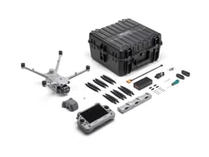
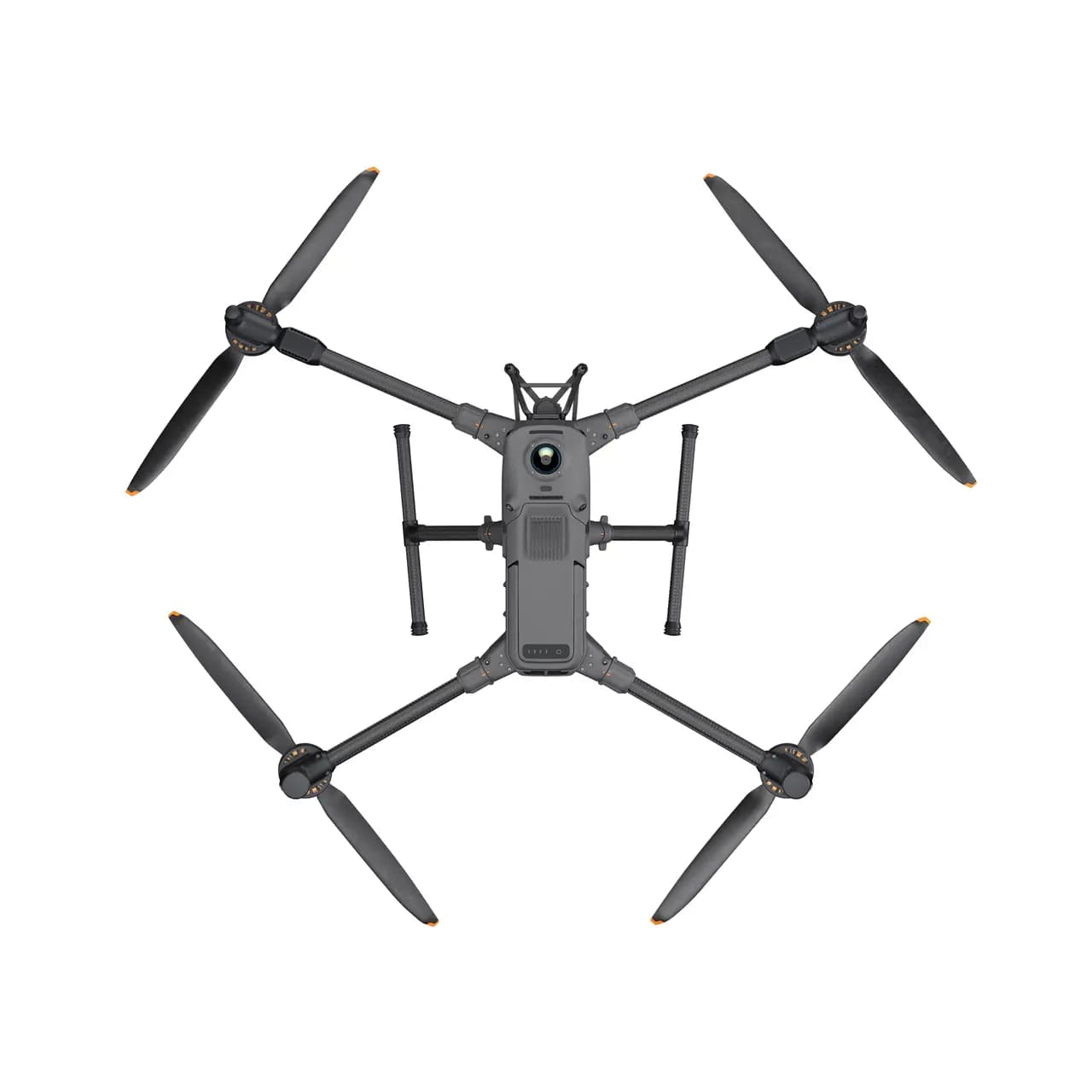
DJI Matrice 400 – Advanced Enterprise Drone
The DJI Matrice 400 is a high-endurance commercial drone designed for professional applications across various industries. Built with robust engineering and intelligent features, it serves as a reliable tool for power inspections, search and rescue, aerial mapping, and surveillance. With a flight time of up to 59 minutes and a payload capacity of 6 kg, this drone ensures efficiency and precision in demanding missions. Everse as an top DJI drone supplier in Bangalore, provides localized support, training, and customization to meet the needs of Indian enterprises.
Key Features of DJI Matrice 400
- Extended Flight Endurance — Up to 59 minutes of flight time while flying forward and 53 minutes while hovering, ideal for long missions.
- High Payload Capacity — Supports up to 6 kg payload with compatibility for multiple devices including cameras, LiDAR, thermal sensors, and speakers.
- Weather-Resistant Build — IP55-rated protection with reliable performance from -20°C to 50°C in rain, dust, and extreme environments.
- Advanced Obstacle Avoidance — Features rotating LiDAR, mmWave radar, and low-light vision sensors to detect thin obstacles like wires in low visibility.
- AI-Powered Automation — Smart object detection, AR overlay for waypoints, terrain follow, and intelligent flight modes for mapping and surveillance.
- Enterprise-Grade Transmission — O4 Enterprise system enables 40 km range with 4G/Sub2G backup and airborne relay for uninterrupted connectivity.
- Industry-Wide Applications — Ideal for energy, rescue, construction, law enforcement, mining, oil & gas inspections, and disaster response.
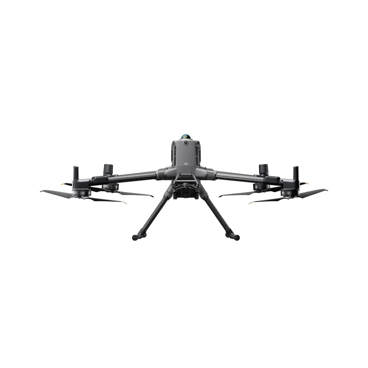
Unmatched Flight Performance
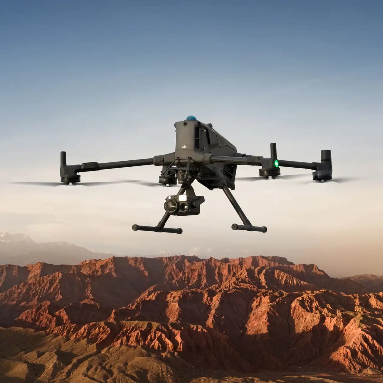
The DJI Matrice 400 stands out with its exceptional flight capabilities. It offers a maximum flight time of 59 minutes when flying forward at a constant speed, making it ideal for long-duration operations. Even while hovering, it can stay airborne for up to 53 minutes, ensuring extended mission durations without frequent battery changes. The drone achieves a top speed of 25 meters per second, allowing rapid deployment in emergency scenarios. Its ability to maintain stability in challenging weather conditions, combined with an IP55 rating, ensures reliable performance in dust, rain, and extreme temperatures ranging from -20°C to 50°C.
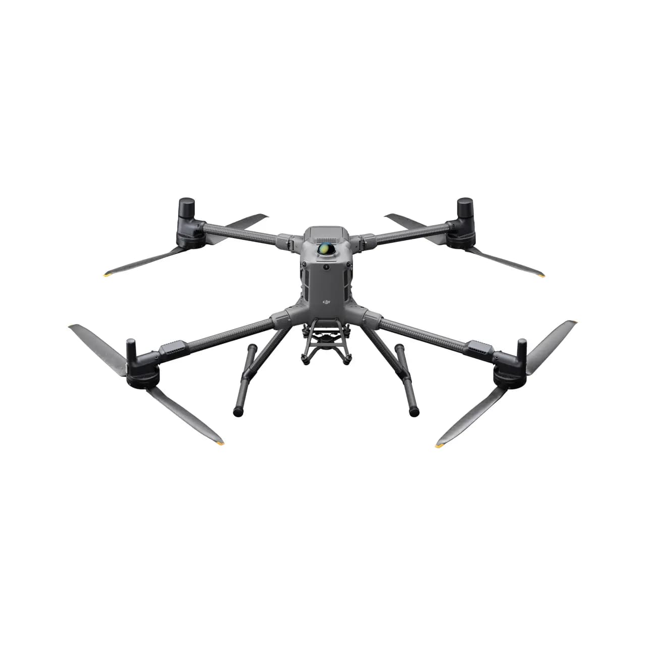
Heavy Payload and Versatile Configurations
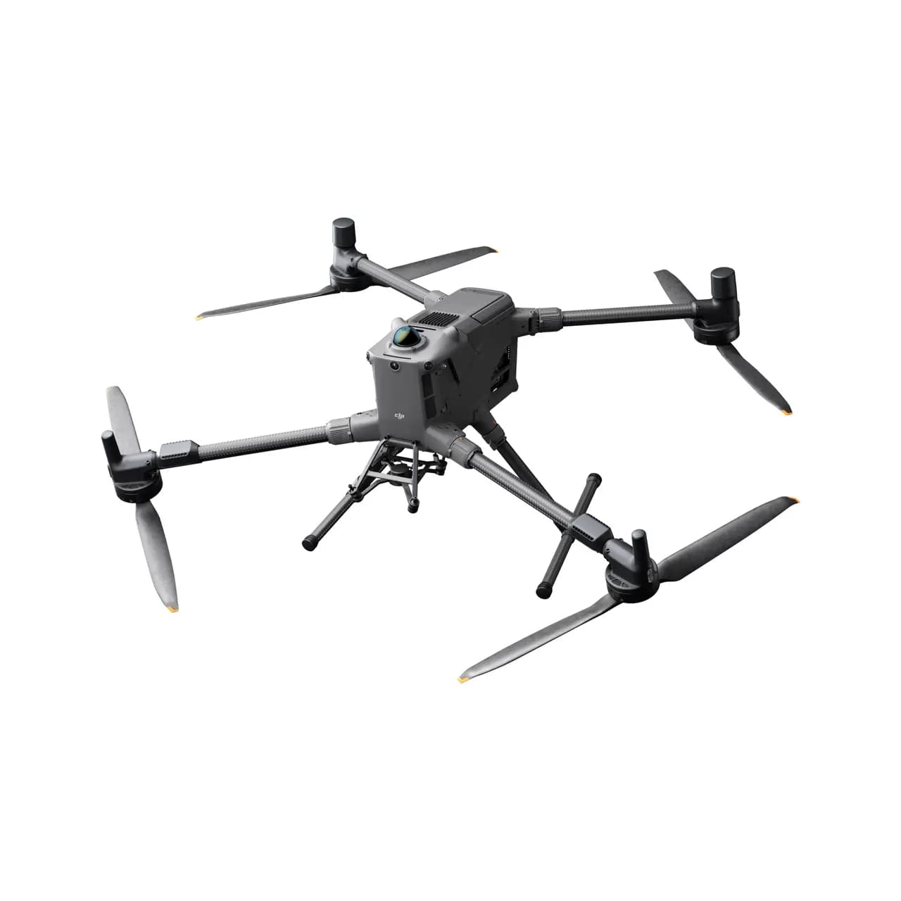
One of the key strengths of the Matrice 400 is its ability to carry multiple payloads. With a maximum payload capacity of 6 kg, it supports a wide range of professional equipment, including high-resolution cameras, thermal imaging sensors, LiDAR systems, and loudspeakers. The drone features multiple expansion ports, allowing users to attach up to seven payloads simultaneously. This flexibility makes it suitable for diverse applications such as industrial inspections, aerial surveys, and public safety missions. Whether it’s capturing high-definition images for mapping or detecting heat signatures in search operations, the DJI Matrice 400 adapts to various professional needs.
Advanced Safety and Obstacle Avoidance
Safety is a critical factor in enterprise drone operations, and the DJI Matrice 400 excels in this aspect. It incorporates a sophisticated obstacle avoidance system that includes rotating LiDAR, mmWave radar, and full-color low-light vision sensors. These technologies enable the drone to detect even thin obstacles like power lines, ensuring safe navigation in complex environments. The mmWave radar enhances performance in adverse weather conditions such as rain and fog, while the vision sensors provide clear imaging in low-light situations. With these advanced safety features, the drone can operate confidently in urban areas, industrial sites, and remote terrains.
Intelligent Automation for Efficient Operations
The Matrice 400 is equipped with smart automation features that enhance operational efficiency. Its AI-powered detection system can identify vehicles, people, and other objects, making it useful for surveillance and monitoring tasks. The drone also supports AR projection, which overlays critical information such as power lines and waypoints on the remote controller’s screen. This feature is particularly beneficial for power grid inspections, where precision is crucial. Additionally, the drone offers real-time terrain follow, maintaining a consistent altitude over uneven landscapes, which is essential for mapping and surveying missions. Automated flight modes, including waypoint navigation and tracking, further simplify complex operations.
Reliable Connectivity and Long-Range Transmission
To ensure seamless communication between the drone and the operator, the DJI Matrice 400 is equipped with the O4 Enterprise Enhanced Transmission system. This technology provides a stable video feed with a range of up to 40 kilometers, making it suitable for large-scale inspections and long-distance missions. The drone also supports 4G and Sub2G backup connectivity, ensuring uninterrupted transmission even in areas with signal interference. Another innovative feature is the airborne relay mode, where one Matrice 400 can act as a signal repeater for another, extending the operational range in challenging environments such as mountainous regions or dense urban areas.
Applications Across Industries
The versatility of the Matrice 400 makes it a valuable asset in multiple sectors. In the energy sector, it is used for inspecting power lines, solar farms, and wind turbines, reducing the need for manual inspections and improving safety. Public safety agencies utilize the drone for search and rescue missions, disaster assessment, and law enforcement operations. Its high-resolution imaging and thermal capabilities make it effective in locating missing persons or assessing damage after natural calamities. In construction and mining, the drone aids in site surveys, progress tracking, and volumetric measurements, enhancing productivity and accuracy. The oil and gas industry benefits from its ability to inspect pipelines and offshore installations, minimizing operational risks.
Local Support and Custom Solutions from Everse
Everse as a trusted drone solutions provider in Bangalore, offers comprehensive support for the Matrice 400. Customers benefit from local stock availability, ensuring quick delivery and reduced downtime. The Everse provides on-site training and certification programs, helping operators master the drone’s advanced features. For enterprises with specific requirements, Everse offers customized solutions, including payload integration and software adaptations. Additionally, after-sales service and maintenance support ensure that the drone remains in optimal condition for long-term use.
The DJI Matrice 400 is a powerful and intelligent drone designed for professional and industrial applications. Its long flight time, heavy payload capacity, and advanced safety features make it a reliable choice for enterprises across various sectors. With smart automation, robust connectivity, and versatile configurations, it enhances efficiency and accuracy in missions ranging from inspections to emergency response. Backed by Everse local expertise and support, the Matrice 400 is an ideal investment for businesses seeking cutting-edge drone technology in India.
Specifications
- Takeoff Weight (with propellers)
Without Batteries: 5020±20 g
With Batteries: 9740±40 g
The actual product weight may vary due to differences in batch materials and external factors. - Max Takeoff Weight
15.8 kg - Dimensions
Unfolded: 980×760×480 mm (L×W×H) (with landing gear)
Folded: 490×490×480 mm (L×W×H) (with landing gear and gimbal)
Maximum dimensions excluding propellers.
Aircraft carrying case: 779×363×528 mm - Max Payload
6 kg
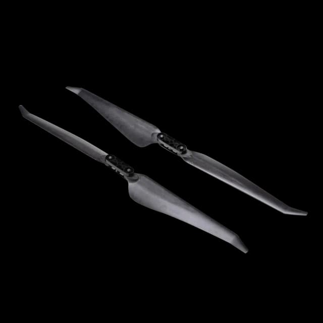
Payload measured at third gimbal connector under sea level conditions. Payload capacity decreases with altitude. Refer to the official manual for details. - Propeller Size
25 inches - Diagonal Wheelbase
1070 mm - Max Ascent Speed
10 m/s - Max Descent Speed
8 m/s - Max Horizontal Speed
25 m/s (at sea level, no wind) - Max Takeoff Altitude
7000 m - Max Flight Time (no wind)
59 minutes
Measured at 10 m/s with H30T (total weight 10,670 g), from 100% to 0%. For reference only. - Max Hover Time (no wind)
53 minutes
Hovering with H30T in no wind, from 100% to 0%. Actual results may vary. - Max Flight Distance (no wind)
49 km
Measured at 17 m/s without external payloads, from 100% to 0%. - Max Wind Speed Resistance
12 m/s (takeoff and landing) - Max Yaw Angular Velocity
100°/s - Max Pitch Angle
35° - Operating Temperature
-20° to 50° C (-4° to 122° F) - GNSS
GPS + Galileo + BeiDou + GLONASS*
Note: GLONASS supported only with RTK module enabled. - ADS-B In
Equipped with airborne ADS-B In receiver and dual antennas
Reception range: up to 20 km - Hovering Accuracy (moderate/no wind)
Vertical:
±0.1 m (vision), ±0.5 m (satellite), ±0.1 m (RTK)
Horizontal:
±0.3 m (vision), ±0.5 m (satellite), ±0.1 m (RTK) - RTK GNSS Accuracy
RTK Fix: 1 cm + 1 ppm (horizontal), 1.5 cm + 1 ppm (vertical)
RTK Heading Accuracy: < 2° - Internal Storage
N/A - Ports
USB-C Debug Port × 1: USB 2.0
E-Port V2 × 4 (bottom-mounted, 120W per port)
Cellular Dongle 2 Interface × 2 (underside) - Propeller Model
2510F - Beacon
Built-in - Ingress Protection Rating
IP55
Note: Rating may reduce with product wear over time.
- Maximum Payload for Single Gimbal Connector
1400 g
If exceeded, the gimbal damper lifespan will decrease from 1000 hours to 400 hours. - Maximum Payload for Dual Gimbal Connector
950 g - Maximum Payload for Third Gimbal Connector
3 kg (quick-release port), 6 kg (screw lock fastening)
- Sensing Type
Omnidirectional binocular vision system (full-color fisheye)
Horizontal rotating LiDAR, upper LiDAR, and downward 3D infrared sensor
Six-direction mmWave radar - Forward
Measurement Range: 0.4–21 m
Detection Range: 0.4–200 m
FOV: 90° (horizontal), 90° (vertical) - Backward
Measurement Range: 0.4–21 m
Detection Range: 0.4–200 m
FOV: 90° (horizontal), 90° (vertical) - Lateral
Measurement Range: 0.6–21 m
Detection Range: 0.5–200 m
FOV: 90° (horizontal), 90° (vertical) - Downward
Measurement Range: 0.5–19 m
FOV: 160° (front/rear), 105° (left/right) - Operating Environment
Forward, Backward, Left, Right, and Upward:
Surfaces with delicate textures and adequate light.
Downward:
Surfaces with rich textures, reflectivity > 20% (walls, trees, people), and sufficient lighting.
*Lighting should be no less than a nighttime city light scene. - Rotating LiDAR
Standard Range: 0.5–100 m @ 100,000 lux (10% reflectivity)
Power Line Detection: 35 m @ 30° @ 10,000 lux (21.6 mm wire)
FOV: 360° (horizontal), 58° (vertical)
Point Frequency: 520,000 points/s
Laser Wavelength: 905 nm
Eye Safety: Class 1 (IEC60825-1:2014) - Upper LiDAR (3D ToF)
Measurement Range: 0.5–25 m at night (reflectivity > 10%)
FOV: 60° (vertical), 60° (horizontal) - Downward 3D Infrared Range Sensor
Measurement Range: 0.3–8 m (reflectivity > 10%)
FOV: 60° (front/rear), 60° (left/right) - mmWave Radar
Power Line Detection:
36 m (12.5 mm wire)
50 m (21.6 mm wire)
FOV: ±45° (horizontal and vertical)
Note: Not available in all regions.
- Resolution: 1080p
- Field of View (FOV):
DFOV: 150°
HFOV: 139.6°
VFOV: 95.3° - Frame Rate: 30fps
- Night Vision: Starlight Grade
- Video Transmission System: DJI O4 Enterprise Enhanced Video Transmission System
- Live View Quality: Remote Controller - 3-channel 1080p/30fps
- Operating Frequency and Transmitter Power (EIRP):
902–928 MHz: < 30 dBm (FCC), < 16 dBm (MIC)
1.430–1.444 GHz: < 35 dBm (SRRC)
2.4000–2.4835 GHz: < 33 dBm (FCC), < 20 dBm (CE/SRRC/MIC)
5.150–5.250 GHz: < 23 dBm (FCC/CE)
5.725–5.850 GHz: < 33 dBm (FCC), < 14 dBm (CE), < 30 dBm (SRRC)
Note: Frequencies vary by region. Always follow local regulations. - Max Transmission Distance (Unobstructed, No Interference):
FCC: 40 km
CE/SRRC/MIC: 20 km - Max Transmission Distance (With Interference):
Strong Interference: approx. 1.5–6 km
Medium Interference: approx. 6–15 km
Weak Interference: approx. 15–40 km - Max Download Speed:
Standard Mode: 80 Mbps Downlink
Playback Download: < 25 MBps
Single-Channel Bitrate: ≤ 12 Mbps - Antenna:
WLAN Antennas × 8 (6 vertical, 2 horizontal)
Sub2G Antennas × 2 (vertical)
4G Antennas × 4
Operating Mode: 2T4R - Others: Supports Dual Control Mode and 2-channel Cellular Dongle 2
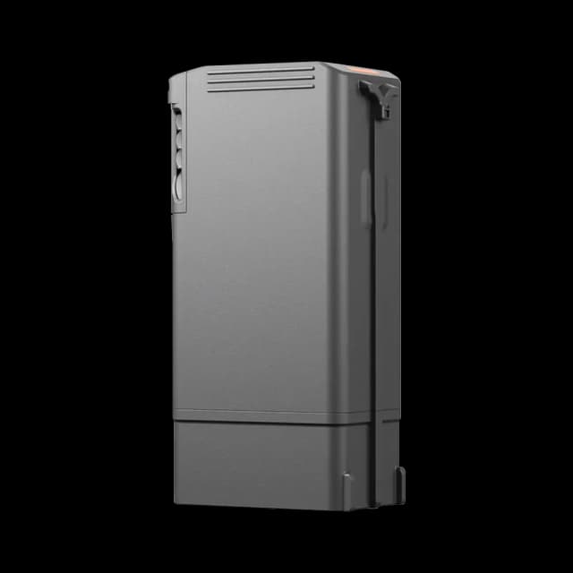
- Model: TB100
- Capacity: 20254 mAh
- Standard Voltage: 48.23 V
- Max Charging Voltage: 54.6 V
- Cell Type: Li-ion 13S
- Energy: 977 Wh
- Weight: 4720 ± 20 g
- Charging Temperature: 5° to 45° C (41° to 113° F)
- Discharging Temperature: -20° to 75° C (-4° to 122° F)
- Battery Heating:
Single Battery: Support
Onboard: Support
Battery Station: Support - Discharge Rate: 4C
- Max Charging Power: 2C
- Low-Temperature Charging: Supports low-temperature self-heating charging
- Cycle Count: 400
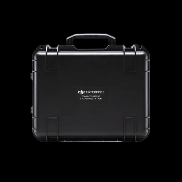
- Model: BS100
- Net Weight: 11.8 kg
- Dimensions: 605×410×250 mm (L×W×H)
- Supported Batteries: TB100 Intelligent Flight Battery, TB100C Tethered Battery, WB37 Battery
- Operating Temperature: -20° to 40° C (-4° to 104° F)
- Input: 100-240 V (AC), 50-60 Hz, 10 A
- Output:
TB100 Battery Interface:
100-110 V: Approx. 1185 W
110-180 V: Approx. 1474 W
180-240 V: Approx. 2184 W
WB37 Battery Interface:
100-240 V: Approx. 52 W
USB-C:
5.0 V 3.0 A, 9.0 V 3.0 A, 12.0 V 3.0 A, 15.0 V 3.0 A, 20.0 V 3.25 A - Number of Charging Channels: Three TB100 and two WB37 batteries
- Charging Mode: Ready-to-Fly Mode 90%; Standard Mode 100%
Supports Fast Charging Mode and Silent Mode - Charging Time:
TB100/TB100C Battery From 0% to 100%:
220 V: 45 minutes (Fast Charging Mode); 110 minutes (Silent Mode)
110 V: 70 minutes (Fast Charging Mode); 110 minutes (Silent Mode)
Charging time is measured in a test environment with a temperature of 25° C.
- Video Transmission System: DJI O4 Enterprise Enhanced Video Transmission System
- Max Transmission Distance:
40 km (FCC)
20 km (CE/SRRC/MIC) - Operating Frequency & Transmitter Power (EIRP):
902-928 MHz: < 30 dBm (FCC), < 16 dBm (MIC)
2.400-2.4835 GHz: < 33 dBm (FCC), < 20 dBm (CE/SRRC/MIC)
5.150-5.250 GHz: < 23 dBm (FCC/CE)
5.725-5.850 GHz: < 33 dBm (FCC), < 14 dBm (CE), < 30 dBm (SRRC) - Antenna: 2T4R, 2.4GHz/5.8GHz multi-beam high-gain antenna
sub2G Module: 2T2R - Enhanced Transmission: Supports DJI Cellular Dongle 2
- Wi-Fi Protocol: Wi-Fi Direct, Wireless Display, IEEE 802.11 a/b/n/ac/ax
Supports 2×2 MIMO Wi-Fi, dual-band simultaneous (DBS), dual MAC, data rate up to 1774.5 Mbps - Wi-Fi Operating Frequency:
2.4000-2.4835 GHz
5.150-5.250 GHz
5.725-5.850 GHz - Wi-Fi Transmitter Power (EIRP):
2.4 GHz: < 26 dBm, < 20 dBm (CE/SRRC/MIC)
5.1 GHz: < 23 dBm (FCC/CE/SRRC/MIC)
5.8 GHz: < 23 dBm (FCC/SRRC), < 14 dBm (CE) - Bluetooth Protocol: Bluetooth 5.2
- Bluetooth Operating Frequency: 2.400-2.4835 GHz
- Bluetooth Transmitter Power (EIRP): < 10 dBm
- Screen Resolution: 1920 × 1200
- Screen Size: 7.02 inches
- Screen Frame Rate: 60fps
- Brightness: 1400 nits
- Touchscreen Control: 10-Point Multi-Touch
- Built-in Battery: 2S2P Li-ion (6500 mAh @ 7.2 V), 46.8 Wh
- External Battery: Optional, WB37 (4920 mAh @ 7.6 V), 37 Wh
- Charging Type: Supports PD fast charging (max 20V/3.25A USB-C)
- Storage Capacity: RAM 8G + ROM 128G UFS + microSD expandable
- Charging Time:
2 hours (internal battery)
2 hours (internal + external batteries)
*Measured with device powered off and standard DJI charger - Internal Battery Runtime: 3.8 hours
- External Battery Runtime: 3.2 hours
- Output Port: HDMI 1.4
- Indicators: Status LED, battery level LED, connection status LED, tricolor light (auto brightness)
- Speaker: Supports buzzer
- Audio: Array MIC
- Operating Temperature: -20° to 50° C (-4° to 122° F)
- Storage Temperature:
Up to 1 month: -30° to 45° C
1–3 months: -30° to 35° C
3–12 months: -30° to 30° C - Charging Temperature: 5° to 40° C (41° to 104° F)
- Supported Aircraft Model: Matrice 400
- GNSS: GPS + Galileo + BeiDou
- Dimensions: 268×163×94.5 mm (L×W×H)
- Weight: 1.15 kg (without external battery)
- Model: TKPL 2
- System Version: Android 11
- External Interfaces: HDMI 1.4, SD 3.0, USB-C (OTG, PD charging), USB-A (USB 2.0)
- Accessories: Strap/waist support
- Gimbal Cameras: Zenmuse H30, Zenmuse H30T, Zenmuse L2, Zenmuse P1
- Accessories: Zenmuse S1 (drone spotlight), Zenmuse V1 (drone speaker), Manifold 3, DJI RC Plus 2 sub2G SDR Module, DJI Cellular Dongle 2
- RTK Stations: D-RTK 3 Multifunctional Station, D-RTK 2 Mobile Station
- Ecosystem Accessories:
- DJI X-Port
- DJI E-Port V2 Development Kit
- DJI E-Port V2 Coaxial Cable Kit
- DJI SKYPORT V3 Adapter Set
- DJI SKYPORT V3 Coaxial Cable Kit
Frequently Asked Questions (FAQs)
- Omnidirectional binocular vision system
- Downward-facing binocular vision system
- LiDAR: horizontal rotating + upward LiDAR
- Downward 3D infrared range sensor
- 6-directional mmWave radar
Obstacle sensing for power lines:
- Up to 25 m/s for main lines (21.6 mm steel-core wire)
- Up to 17 m/s for main + distribution lines (12 mm)
Performance depends on conditions like fog, rain, snow, and object material or shape. mmWave radar may not be available in all regions.


%20Basic%20Combo%20Drone.webp&w=640&q=75)