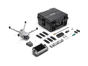


DJI Matrice 4T Worry-Free Plus Combo
Same day dispatch, Order before 2:30 PM
30 days easy returns
24 / 7 support service
Cash on Delivery option available
1-Year Software Warranty
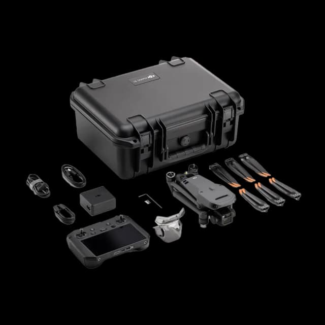
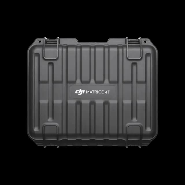
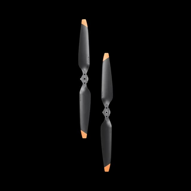
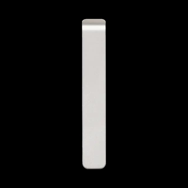
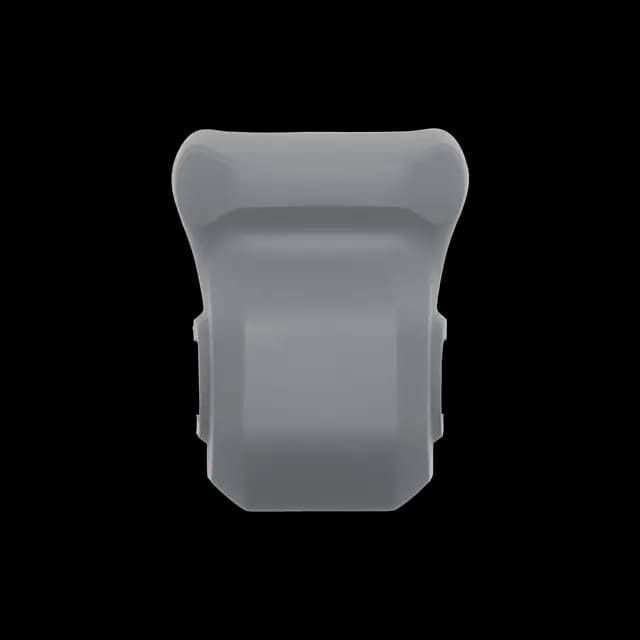
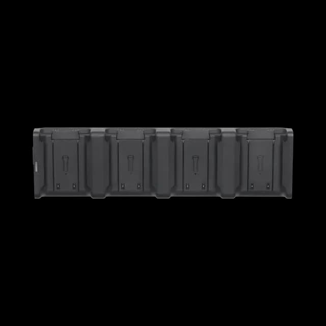
In The Box


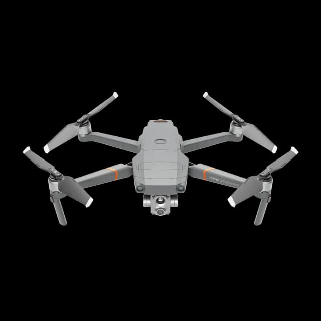
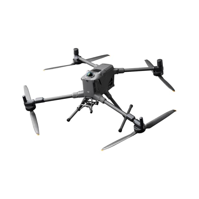
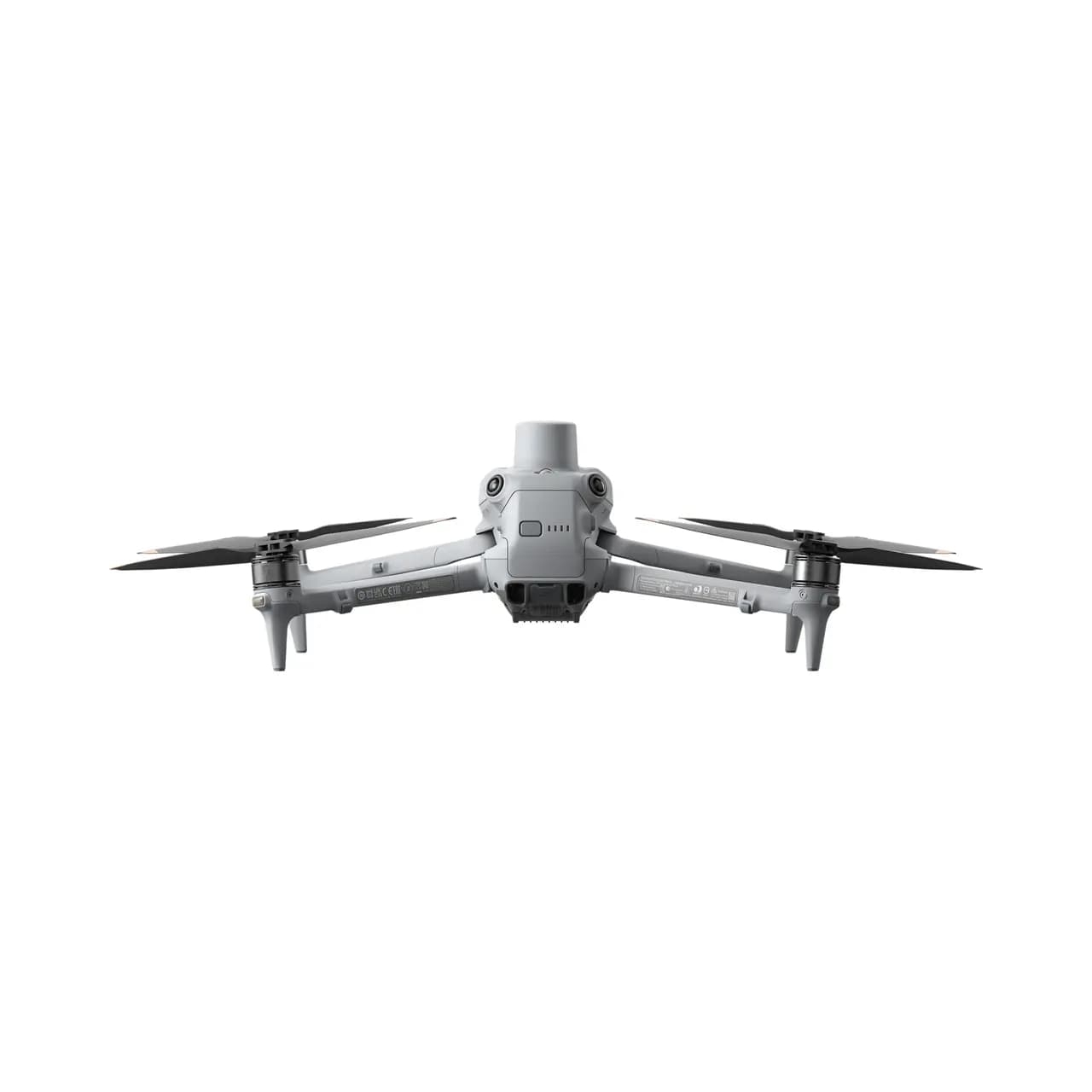
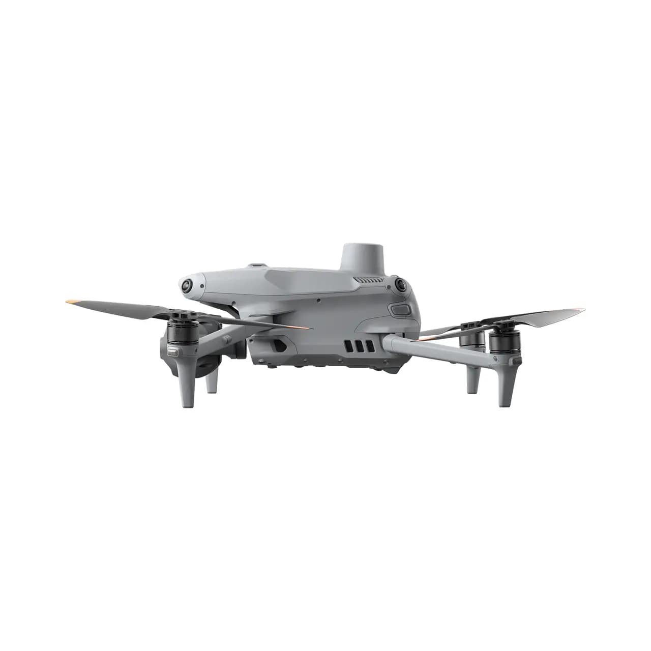
DJI MATRICE 4T
Meet the DJI Matrice 4 Series, the ultimate enterprise drone for aerial intelligence, surveying, mapping, and public safety. This compact yet powerful multi-sensor drone features an advanced laser rangefinder, smart detection, and enhanced safety systems for precise and reliable industrial drone operations.
The Matrice 4T is ideal for electricity inspections, emergency response, forestry conservation, and public safety, while the Matrice 4E is built for geospatial applications, construction, and mining. With upgraded drone accessories, improved flight reliability, and cutting-edge sensing capabilities, the Matrice 4 Series takes enterprise UAV technology to the next level.
DJI Matrice 4 Series: Next-Level Imaging & Precision Sensing
The DJI Matrice 4 Series redefines aerial intelligence with its powerful multi-sensor system, delivering high-resolution imaging, precise measurements, and advanced thermal capabilities for professional applications.
Crystal-Clear Imaging with Triple Cameras
-
Wide-Angle Camera: Equipped with a 1/1.3″ CMOS sensor, 48MP resolution, and f/1.7 aperture, this 24mm equivalent lens captures stunning wide-area visuals, ideal for surveying, mapping, and environmental monitoring.
-
Medium Tele Camera: Featuring a 1/1.3″ CMOS sensor, 48MP clarity, and f/2.8 aperture, this 70mm equivalent lens provides detailed mid-range imaging, perfect for infrastructure inspections and law enforcement.
-
Tele Camera: With a 1/1.5″ CMOS sensor, 48MP resolution, and f/2.8 aperture, this 168mm equivalent zoom lens allows for high-precision long-range surveillance in critical operations.
Laser Range Finder – Precision at Its Best
-
Measurement Range: Up to 1800m with pinpoint accuracy.
-
Oblique Incidence Range: Measures up to 600m at a 1:5 angle, ensuring accurate terrain mapping and 3D modeling.
-
Range Accuracy: ± (0.2 + 0.0015 × D), delivering ultra-precise distance calculations for surveying, construction, and emergency response.
Infrared Thermal Camera – See Beyond the Visible
-
Resolution: 640 × 512 with f/1.0 aperture for detailed thermal imaging.
-
53mm Equivalent Focal Length: Enhances firefighting, search-and-rescue, and industrial inspections.
-
Uncooled VOx Microbolometer: Provides high-res thermal detection for night operations and heat mapping.
NIR Auxiliary Light – Optimized for Low-Light Operations
-
6° FOV with 100m Illumination Distance for enhanced night vision and security surveillance.
Powering the Future of Enterprise Drones
From surveying and mapping to public safety and industrial inspections, the DJI Matrice 4 Series delivers unmatched clarity, precision, and efficiency. Whether capturing high-resolution images, measuring distances with accuracy, or detecting heat signatures, this drone sets a new standard in enterprise UAV technology.
Upgrade your aerial operations today!
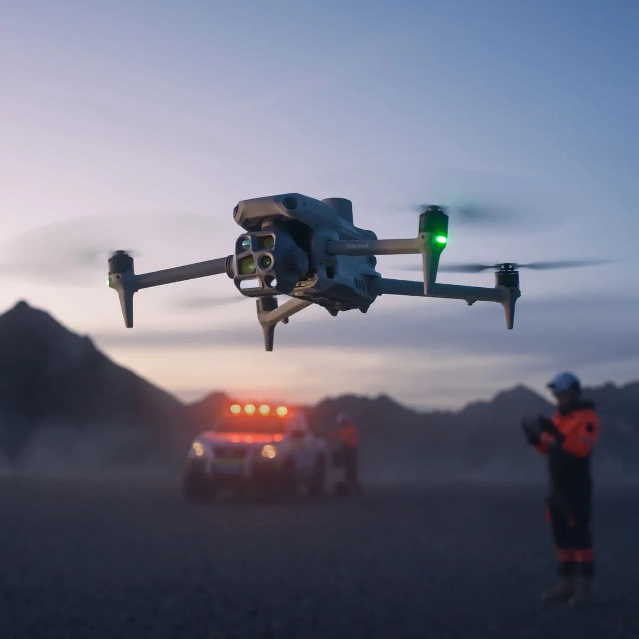
Unleash Precision & Power: The Ultimate Enterprise Drone
In today’s fast-paced industries, having a reliable, intelligent, and high-performing drone is a game-changer. Whether you're in mapping, surveillance, or industrial inspections, our latest DJI Enterprise Drone is built to deliver unmatched precision and efficiency in any environment.
Excel in Low-Light Environments
No more struggling with visibility! With advanced low-light sensors, this drone captures clear, stable images even in challenging conditions.
High-Precision Mapping & Navigation
Experience next-level accuracy with high-efficiency precision mapping—perfect for surveying, inspections, and security operations.
Intelligent Operations for Maximum Efficiency
With AI-powered flight automation, this drone adapts to your needs, ensuring smooth, intelligent performance for every mission.
Comprehensive Accessory Upgrades
From enhanced cameras to modular payloads, this drone supports a wide range of customizable accessories for diverse applications.
Enhanced Flight Safety & Stability
With advanced obstacle avoidance and flight stability, this drone guarantees safe and secure operations, even in complex environments.
DJI Care Enterprise – Protection You Can Trust
Enjoy peace of mind with DJI’s enterprise-grade service plans, offering comprehensive coverage and hassle-free repairs.
INTELLIGENT OPERATIONS
SMART OPERATIONS
Our advanced AI-powered model can instantly detect vehicles, vessels, and people, making search and rescue missions and routine flights more efficient than ever. Need more flexibility? Easily switch to different models to expand your drone’s capabilities for various applications. Plus, with high-resolution grid photography and powerful tracking features, you’ll capture every detail with precision and confidence.
Laser Range Finder: Precision at Your Fingertips
Our AI-powered Laser Range Finder delivers real-time, high-precision measurements, making it a game-changer for search and rescue, inspections, and mapping. With simple tools like pinpointing, line drawing, and area calculation, you can effortlessly mark target locations, measure distances, or even calculate the area of a wildfire.
Seamless data sharing through DJI Pilot QR codes or FlightHub 2 ensures faster collaboration, keeping your team connected and improving workflow efficiency. Whether in high-stakes rescue missions or detailed site inspections, this tool enhances accuracy, boosts productivity, and expands operational capabilities.
Experience precision like never before!
Smart Observation & Range Recording with DJI Pilot 2
With AI-powered precision, DJI Pilot 2 enhances search and rescue missions, patrols, and inspections by highlighting key observation points. It pinpoints the center of the camera frame and ground area in real time, ensuring accurate tracking and high-resolution monitoring.
For operations in mountainous or low-visibility environments, it seamlessly displays the surveyed area on the map, making navigation easier and expanding operational capabilities. Whether for rescue teams or security patrols, this feature improves situational awareness and efficiency.
Stay focused. Stay in control. Elevate your operations today!
Excel in Low-Light Environments with Advanced Night Vision
NIGHT SCENE MODE
The Matrice 4 Series takes night operations to the next level with its upgraded AI-powered Night Scene Mode. Featuring Full-Color Night Vision with three adaptable modes and two levels of enhanced noise reduction, it ensures crystal-clear visibility even in total darkness.
Equipped with an IR Cut Filter and NIR auxiliary light, this drone effortlessly overcomes low-light challenges, making search and rescue missions, surveillance, and inspections more precise than ever. No more guessing in the dark—track subjects with high-resolution clarity and expand your operational capabilities with confidence.
Smart Low-Light Photo: Capture Clarity in the Dark
The Matrice 4 Series redefines low-light photography with its AI-powered intelligent camera system. Featuring larger apertures and advanced noise reduction, it delivers high-resolution images with exceptional clarity, even in dusk or nighttime conditions.
Whether you're conducting search and rescue missions, surveillance, or mapping operations, this cutting-edge low-light technology ensures enhanced visibility and precise tracking—expanding your capabilities when it matters most.
NIR Auxiliary Light: Illuminate the Night with Precision
The Matrice 4T is equipped with advanced NIR illumination hardware, extending lighting distances up to 100 meters. This powerful feature ensures high-resolution visibility in total darkness, making it an essential tool for search and rescue, wildlife protection, and surveillance operations.
With its AI-powered tracking features, the NIR Auxiliary Light enhances situational awareness and operational efficiency, allowing you to see more, react faster, and perform with confidence—even in the most challenging low-light conditions.
Thermal Imaging: Precision in Every Pixel
The Matrice 4T takes thermal imaging to the next level with its AI-powered infrared High-Res Mode, delivering image resolutions up to 1280 × 1024. Its Ultra-High Resolution feature captures even the smallest temperature variations, making it an essential tool for search and rescue, industrial inspections, and wildfire monitoring.
Each device undergoes temperature accuracy calibration and features an onboard temperature sensor for real-time thermal measurements, ensuring precise data for critical operations. Whether you’re detecting heat signatures or monitoring environmental conditions, this advanced thermal system expands your capabilities like never before.
Low-Light Fisheye Omnidirectional Sensing: Navigate with Confidence
The Matrice 4 Series is equipped with six high-definition low-light fisheye vision sensors, providing unmatched obstacle detection and positioning in dark or complex environments. This AI-powered technology ensures automatic obstacle avoidance, intelligent rerouting, and a safe return, even in urban low-light conditions.
Whether for search and rescue, surveillance, or industrial inspections, this advanced sensing system expands operational capabilities, allowing pilots to fly with precision, safety, and confidence—day or night.
Crystal Clear Vision: Unveil Every Detail
Enhanced Medium Telephoto – Precision at a Distance
The Matrice 4 Series features a medium telephoto camera, designed for medium-range inspections. Whether examining power lines, bridges, or substations, it detects screws, cracks, and instrument readings from 10 meters away, ensuring efficient and accurate assessments.
Super Resolution Telephoto – See Farther, Capture More
Equipped with a 48MP high-resolution telephoto camera, the Matrice 4 Series delivers exceptional clarity, capturing fine details from signs up to 250 meters away. The IR-Cut Filter ensures 24/7 operation, making it ideal for search and rescue, infrastructure monitoring, and security surveillance.
Advanced Telephoto Stabilization – Steady & Clear Imaging
With enhanced stabilization, the Matrice 4 Series keeps foreground subjects sharp and steady, even at 10x zoom or higher. Whether for public safety, industrial inspections, or tracking operations, every detail remains crisp and clear.
Precision Mapping: Faster, Smarter, and More Efficient
Rapid 0.5-Second Interval Shooting – Maximize Efficiency
The Matrice 4E features a wide-angle camera that supports 0.5-second interval shooting in orthophoto and oblique photography modes. With a mapping flight speed of up to 21 m/s, it enables high-speed aerial surveys, significantly boosting efficiency in large-scale mapping operations.
Multi-Directional Capture – Expand Your Capabilities
5-Directional Oblique Capture
The Matrice 4 Series introduces 5-directional oblique capture, allowing the gimbal to rotate intelligently and shoot at multiple angles in a single flight. This AI-powered feature ensures faster, more accurate aerial mapping, enhancing small drone oblique photography efficiency.
3-Directional Ortho Capture
Supporting 3-directional ortho capture, the Matrice 4E captures lateral and top-down images in a single pass. This reduces lateral overlap and enables a single flight to cover up to 2.8 km², eliminating the need for additional elevation adjustments. Combined with DJI Terra, it enhances reconstruction accuracy and efficiency.
Smart 3D Capture – Precision Modeling Made Easy
With Smart 3D Capture, users can create a rough 3D model in real-time directly on the remote controller. This model helps generate precise mapping routes, allowing for detailed measurements and modeling of irregular structures. Virtual space routes and waypoint previews ensure safe, efficient flight planning.
Distortion Correction 2.0 – Accuracy at Every Pixel
The Matrice 4E uses high-precision in-camera distortion correction with a residual distortion of less than 2 pixels. Each wide-angle camera undergoes factory calibration, ensuring optimal accuracy when paired with DJI Terra for mapping and reconstruction.
Auto-Generated Survey Reports – Smarter Insights, Fewer Repeat Flights
After each operation, DJI Pilot 2 automatically generates a detailed survey quality report, providing insights on photo points, RTK status, and imaging parameters. If anomalies are detected, additional images can be captured on-site, reducing the need for costly repeat flights.
Safe Flight, Worry-Free Operation
Fusion Positioning – Reliable Return-to-Home in Any Condition
The Matrice 4 Series features an integrated DJI RTK module with GNSS+Vision Fusion Positioning, ensuring precise navigation even in challenging environments. Supporting the extended L5 frequency band, it enables rapid takeoff within 15 seconds and can return home even without GNSS signals, overcoming urban signal obstructions and interference with ease.
Intelligent Guidance – Fly with Confidence
When connected to the internet, the DJI RC Plus 2 Enterprise controller loads terrain elevation maps and preloads detailed navigation data for automated path planning and obstacle avoidance. Whether navigating at night or over mountainous terrain, the 5-directional vision assist system and downward vision sensors provide comprehensive visibility and protection.
Next-Level Video Transmission – Unmatched Clarity & Range
The O4 Enterprise video transmission system sets a new industry standard, offering a 25 km transmission range with 8-antenna technology. With a 20MB/s download bandwidth, it doubles the bitrate of previous models, delivering clearer, more stable imagery for real-time route uploads and material downloads.
For even greater signal stability, the Matrice 4 Series supports the optional DJI Cellular Dongle 2, combining 4G transmission with built-in aircraft antennas to ensure seamless connectivity in any environment.
Company Vision
From intelligent drones to humanoid and companion robots, we bring innovation that empowers industries, creators, and communities for a smarter, connected future.

Trusted by Industry Leaders