
Elevate Your Vision: Multi-Sensor Precision in Every Flight
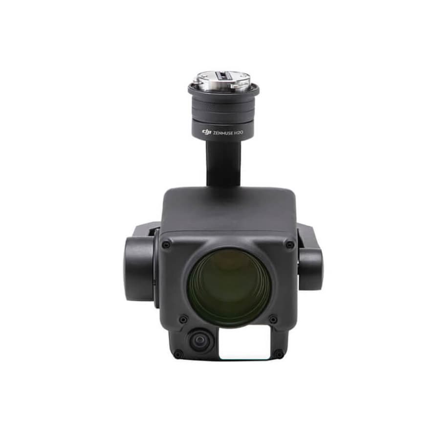
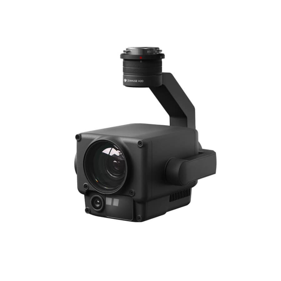
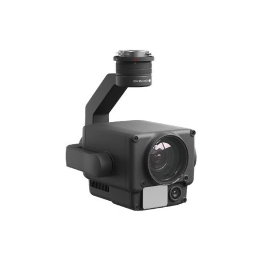
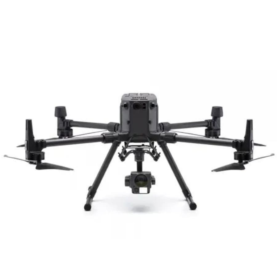
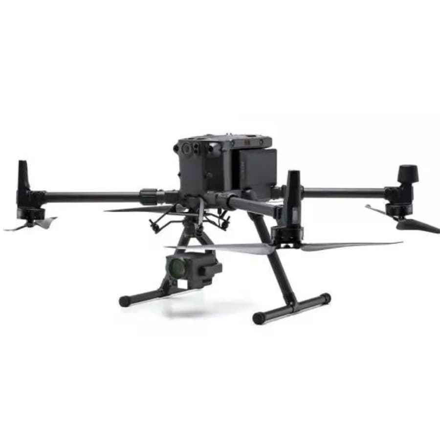
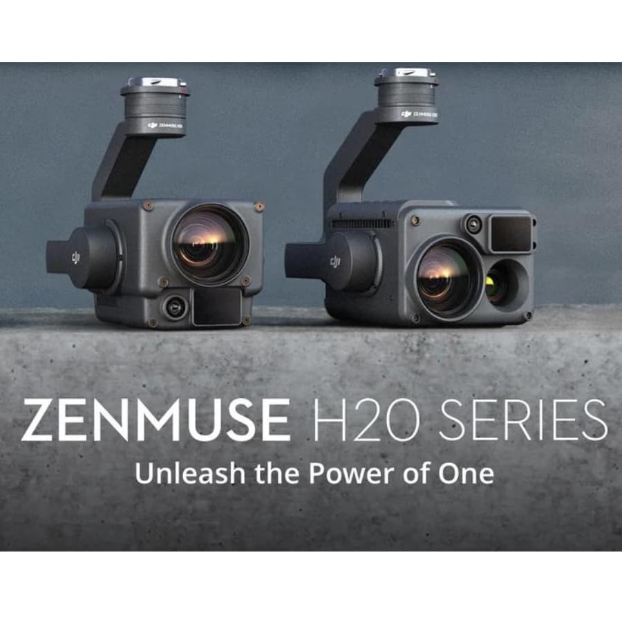
The DJI Zenmuse H20 is a versatile, multi-sensor payload designed for aerial inspection and data collection, compatible with DJI’s Matrice series of drones. This advanced camera system integrates multiple powerful sensors into one compact unit, offering an array of capabilities to enhance operational efficiency and precision for a variety of applications. It features a 20MP zoom camera with a 23x hybrid optical zoom, a 12MP wide-angle camera, and a laser rangefinder with a range of up to 1200 meters. The H20 also includes a radiometric thermal camera, allowing for temperature measurements from the air, which is invaluable for tasks such as infrastructure inspection, search and rescue operations, and environmental monitoring. Its integrated AI capabilities enable smart features like subject tracking and automatic identification, making it a powerful tool for professionals seeking to leverage aerial technology for detailed, accurate data gathering and analysis.
The DJI Zenmuse H20 series elevates aerial imaging for industrial and public safety operations with its multifaceted capabilities. Here’s an in-depth exploration of its comprehensive feature set:
📸 Triple-Sensor Configuration: This configuration integrates a high-resolution 20MP Zoom Camera for detailed imagery, a 12MP Wide Camera for expansive coverage, and a Laser Rangefinder for precise distance measurements up to 1,200 meters, offering a holistic view of operational environments from the air.
🔍 Advanced Hybrid Zoom Technology: The zoom camera’s 23x hybrid optical zoom, extending to a 200x maximum zoom, allows operators to capture exceptionally detailed images from great distances. This capability is crucial for maintaining operator safety while ensuring thorough surveillance and inspection accuracy.
🌙 Enhanced Night Vision Capabilities: The wide camera’s high-sensitivity starlight sensor ensures clear, detailed images in low-light conditions or complete darkness, making the H20 series indispensable for night-time operations and emergency response.
🎯 Laser Rangefinder Accuracy: With the ability to measure distances accurately within a range of 3m to 1,200m, the laser rangefinder supports diverse applications, including precise mapping, surveying, and strategic planning, by providing exact location data.
💧 Robust IP44 Rating: Its construction is designed to resist water and dust from any direction, granting reliable performance under various adverse conditions, from rain-soaked environments to dusty operational sites, ensuring mission continuity.
🔁 Intelligent Smart Tracking: Utilizing sophisticated algorithms, the H20 series can automatically identify and follow moving subjects, greatly simplifying tasks in dynamic scenarios such as search and rescue missions or continuous surveillance activities.
🔄 Automated AI Spot-Check: This feature revolutionizes routine inspections by enabling the camera to autonomously revisit and capture identical shots over time at the same angle, zoom level, and location, greatly enhancing inspection efficiency for infrastructure and environmental monitoring.
🗺️ Immediate Real-Time Mapping: The capability to generate real-time maps directly during flight missions provides instant insights, allowing decision-makers to act swiftly without the delay of data processing, critical in time-sensitive operations.
✅ Simplified One-Tap Capture: A user-friendly interface allows operators to mark objects of interest with a single tap, instantly calculating their coordinates. This information is then projected across all camera views, streamlining target tracking and operational workflows.
🌐 Comprehensive 360° Scanning: Continuous 360-degree rotation capability ensures complete area coverage, eliminating blind spots during surveillance or inspection tasks, and offering a panoramic view for thorough analysis.
🕒 Optimized Efficient Power Management: Designed to maximize flight times when used with compatible DJI drones, the H20 series enables longer missions, expanding operational scope and enhancing the efficiency of aerial tasks.
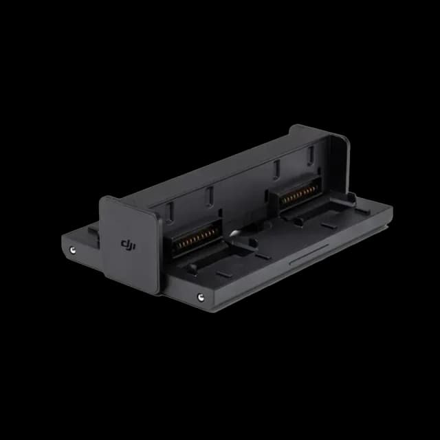
⚙️ Seamless Platform Integration: Specifically engineered for compatibility with the DJI Matrice 300 RTK and other DJI platforms, the H20 series offers easy, plug-and-play deployment, facilitating rapid readiness for a variety of missions.
🌡️ High-Resolution Thermal Imaging (H20T Model): The H20T model incorporates a radiometric thermal camera, vital for capturing detailed temperature data across vast areas. This is especially beneficial for firefighting, search and rescue operations, and energy infrastructure inspections, where thermal data can pinpoint hotspots or areas of heat loss.
👀 Versatile Multiple Payload Configurations: The ability to use all sensors simultaneously allows for flexible operation, enabling users to switch between different feeds with ease or view multiple feeds concurrently for a multi-dimensional understanding of the operational environment.
💨 Advanced Active Image Stabilization and EIS: Ensures that footage remains smooth and stable under challenging conditions, including windy environments or high-speed movements. This technology is key to obtaining high-quality, usable imagery and video for analysis and decision-making.
The DJI Zenmuse H20 series sets a benchmark for aerial imaging systems, combining unparalleled versatility, advanced technology, and user-friendly features to support a wide range of industrial and public safety applications, demonstrating DJI’s leadership in UAV innovation.